
GEORGETOWN, EXHUMES TO HOPE TOWN, ABACOS
 |
INSTALLMENT NO 10DATE: April 23, 2001Miles Traveled272.5(nautical) Engine Hours:50.0 Generator Hours:0 Sailing Hours:13.5 |
GEORGE TOWN TO CAT ISLAND
 We motor sailed Perce Neige, along with Barefoot'n to Cat Island in the outer Bahamas, and managed to negotiate a tricky approach to dock our vessels at the beautiful Hawk's Nest Resort and Marina. The tide was low and Barefoot'n, which draws nine inches more than us, scraped the bottom of the creek, which leads to the entrance of the marina.
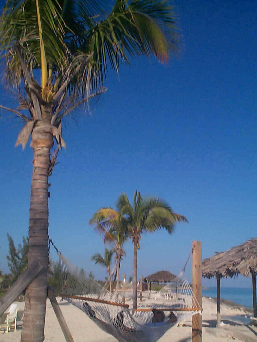
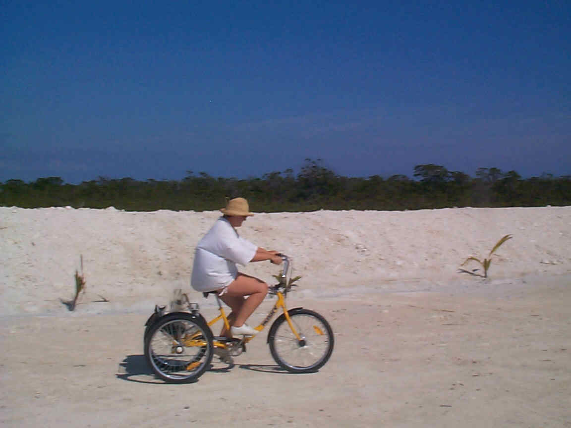
The Hawk's Nest is a 4 star resort, which caters to the "fly in" crowd, but is starting to handle the needs of sailors. The runway is long enough to handle small jets and one stood out among the crowd of small propeller driven types. The marina itself was still under construction and showers were not available, but we filled up the tanks with good water from their aquifer at 40c per gallon and declined an expensive electrical hook up as our batteries were charged from the days run. The resort which has a pool, beautiful grounds and a beach, is about half a mile from the marina, where we were one of only four sailboats. Bicycles and gulf carts were available for our transportation
We enjoyed a buffet dinner at the resort and were treated to fresh fish caught by one of the power boaters as well as a variety of other delicious foods.
HAWK'S NEST TO NEW BIGHT
 We left the next day for a two-hour trip across the shallow bay known as the "bight" of Cat Island. While we were motoring in only 20 feet of water several dolphins came to visit us and one of them rode our bow wave for several minutes, until I brought out the camera, whereupon he promptly left before we could use it. This seems from our previous encounters, to be standard dolphin operating procedures.
We anchored off the town of New Bight (Old Bight is a little further north) and we went ashore to visit a building known as the Hermitage. From the shore the Hermitage looks like a large and very striking building perched on the highest hill not only on the island, but even the highest hill in the Bahamas according to our Explorer chart book. The original rough track to the Hermitage is very steep and equally rough. It has the visitor wondering if perhaps he is on a pilgrimage. An easier section has been roughly cleared wide enough so that a 4x4 could perhaps handle it. The pathway is very steep and involves steps in the rocks, which cause one to pass by carved plaques depicting the Stations of the Cross.  We found the building itself to be quite surprising when we finally arrived, as it is much smaller than it appears from the beach. It has been scaled down and the doors are so small that even Jeffrey (5'5" in his sandals) had to stoop to get inside. The rooms are very small and suffice for only one person. The bell tower is perhaps 15 feet tall and can be climbed from the inside. The waves breaking over the reefs on the east side of Cat Island can be clearly seen from the tower.
We took the easy route back but it was a mistake the dust of the construction was choking.
CAT ISLAND TO LITTLE SAN SALVADOR
 We retraced some of our path to New Bight to avoid the "Bonefish shoals" and proceeded north to West Bay on the very pretty island of Little San Salvador where we anchored in the company of the Holland America Cruise Ship, Vandaark. The cruise line has taken over the western bay area and their cruise ships anchor off "Half Moon Bay" (as the cruise line now calls it). We called the ship on channel 16 to find out the best way to approach them and were asked to go around their stern to, avoid the constant traffic to their shore facility, and to anchor in the
north-west corner of the bay. We followed their request and found ourselves in 15 feet of clear turquoise water only a hundred feet from the beach. There was only one other cruising boat but the rest of the bay was awash with tourists riding "banana boats", parasailing and being ferried between the ship and the shore. The beach was covered in well-oiled bodies. Diane asked one of the passing riders when they were leaving and he replied 4 p.m. Sure enough by 3.30 they were all in the mother ship and by 4.15 we had the place to ourselves. It would have been good to stay for another day and have the place to ourselves but the weather was forecast to deteriorate in another day or two and so we motored a few hours to Eluthera Point Marina.
We retraced some of our path to New Bight to avoid the "Bonefish shoals" and proceeded north to West Bay on the very pretty island of Little San Salvador where we anchored in the company of the Holland America Cruise Ship, Vandaark. The cruise line has taken over the western bay area and their cruise ships anchor off "Half Moon Bay" (as the cruise line now calls it). We called the ship on channel 16 to find out the best way to approach them and were asked to go around their stern to, avoid the constant traffic to their shore facility, and to anchor in the
north-west corner of the bay. We followed their request and found ourselves in 15 feet of clear turquoise water only a hundred feet from the beach. There was only one other cruising boat but the rest of the bay was awash with tourists riding "banana boats", parasailing and being ferried between the ship and the shore. The beach was covered in well-oiled bodies. Diane asked one of the passing riders when they were leaving and he replied 4 p.m. Sure enough by 3.30 they were all in the mother ship and by 4.15 we had the place to ourselves. It would have been good to stay for another day and have the place to ourselves but the weather was forecast to deteriorate in another day or two and so we motored a few hours to Eluthera Point Marina.
ELUTHERA POINT MARINA
On arrival at the marina, we were directed to a very economic slip (45c per ft.) with electricity (extra), however as our alternator had decided to quit for the third time this trip, we deemed it necessary to have AC shore power. Jeffrey fixed the alternator again a few hours after our arrival, but we stayed connected to give the fridge a chance to really cool down. Steve and Val on Barefoot'n, had to manage their electrical needs with their wind generator.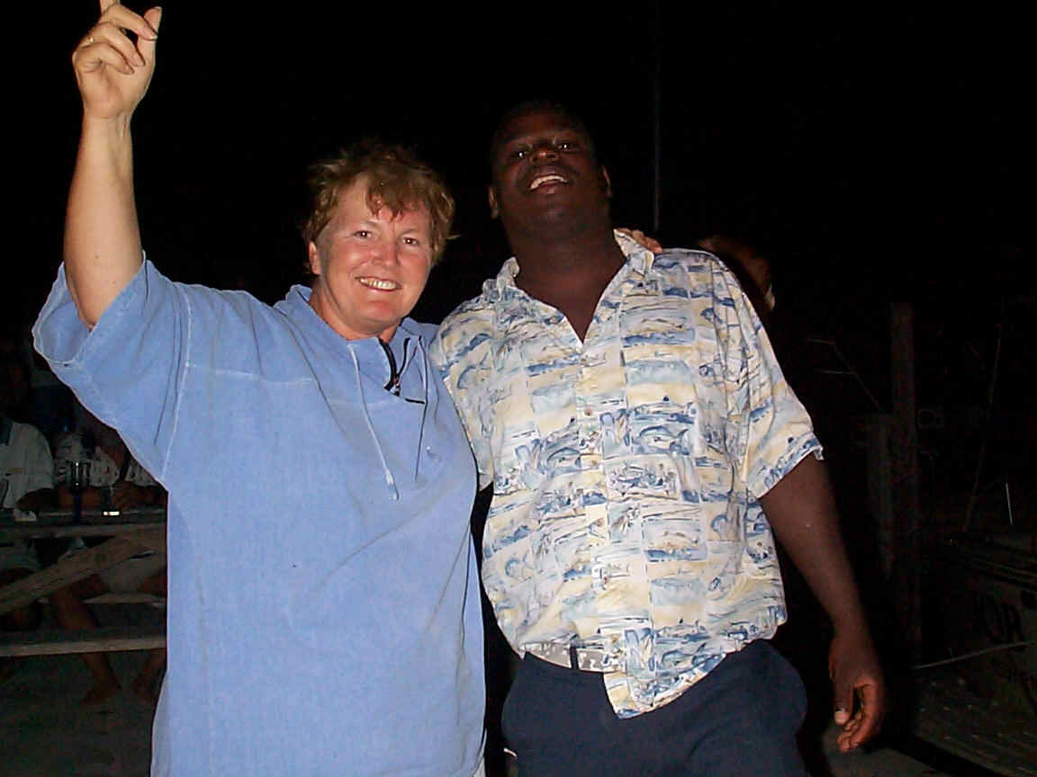 We found to our delight that the marina had organized a dock party for that evening. There was food, paid for by the marina. Each boat provided their own drinks and put in a few dollars to pay for the "one man band", which did a great job of getting Jeffrey up to dance with a cute Bahamian lady. Jeffrey is not known as a party animal and Diane was simply too amazed to be jealous.
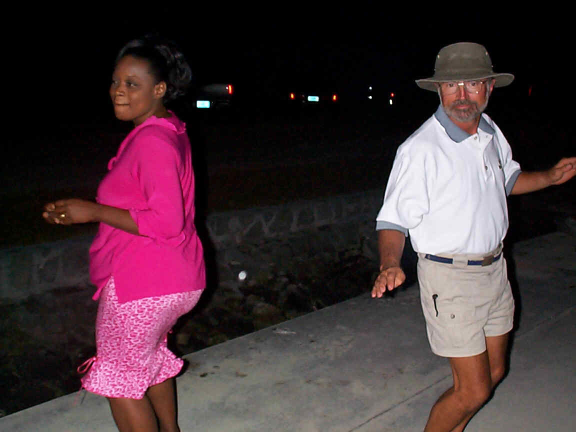
After the party a large sports fishing boat, "ODD Man Too", arrived and the crew brought ashore several tuna, weighing about 40 lbs. each. As the designated crewmember expertly filleted each tuna, he threw the unwanted parts into the bay and after a while, along came an eight-foot nurse shark, which proceeded to devour them. It was something like feeding scraps to dog however no one tried to pet him. Val must have used her charm, as the boat owner gave her a large portion of tuna, which Steve barbequed for us on Barefoot'n the next evening.
The next day we all piled into a Nissan, owned and driven by Perrilyne, one of the friendly Bahamian ladies who had been at the previous nights party. She took us on a tour stopping at Rock Point, where we purchased groceries and handled email, and at Davis Harbour, where there was another Marina. We had considered going into Davis Harbour but had rejected it, as the channel seemed too shallow for Barefoot'n to safely navigate. It turned out to be a well-kept marina, which was, for the most part, run as a private club for some of the people with large houses nearby. Although the channel was well marked there were no sailboats, leading us to believe that we had made the correct decision.
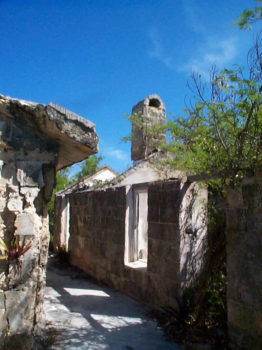
Perrilyne informed us of the demise of several of the island's resorts, and of the hardship, which this had caused to many Elutheran islanders. Evidently the Eluthera Point Marina had itself been part of a vacation complex, which was now only evidenced by the concrete footings of the buildings. The roads and pathways, and an extensive golf course had been quickly overgrown. Also Club Med had abandoned their village on the island making the Princess Village the only current major resort. This resort was restricted to cruise ship passengers, like the complex on Little San Salvador, (see above) but this time to people visiting from the Princess Cruise Ships. We explored the area around the marina and found the partly blocked road to the abandoned golf course, which now had trees growing through the tarmac. We were quite surprised to encounter the ruins, of what we supposed to have been a large and quite luxurious hotel. It had obviously been engulfed by fire. The roof was non-existent but the stone columns of the entrances and most of the soot-covered walls still stood, along with heaped ceramic tiles and rusted kitchen equipment. It was a stark reminder of the ease with which nature in a tropical paradise can take over the anything if left to it's own devices.
GOVERNOR'S HARBOUR
 We headed to Governor's Harbour after the last cold front had passed and quickly realized that the next cold front was right behind last one! We enjoyed this colourful town where the houses seemed to be better looked after than many of the other place we had encountered and new houses were being built. The exception was Cupids Cay where the houses were generally old abandoned or often in need of serious repairs. Cupids Cay was also the area where the mail boat and the ferry came in. The ferry was a large motor catamaran and built for speed. There were many people who got onto the ferry who worked elsewhere, probably Nassau, and came home for weekends.
While in Governors harbour a front came through. We were on land at the time and Perce Neige started to drag her anchor. Luckily we were within sight of the boat and Steve and Jeff were able to quickly dinghy out and re-anchor. The bottom was described in the charts as "Very poor holding". Considering our dragging problems and the twenty foot steel ladder, which Barefoot'n brought up when they tried to anchor, we would conclude that the charts are correct, in this instance.
ALABASTER CAY AND JAMES CISTERN
 After leaving Governor's Harbour we proceeded north along the west coast of Eluthera to Alabaster Bay and anchored east of Pelican Cay. Yet another cold front was forecast and we did not want to be in Governor's Harbour dragging our anchors a second time. The holding at Alabaster was very good and we slept much better than we had for the previous two nights. We reviewed our charts and found that there was a pink sand beach on the Atlantic side of the island. This exited Diane and she cajoled us into searching for this beach in spite of the fact that the chart did not show any road, which went to this beach. Well, it was good exercise at least, and we got to see more of the island including the airport, which was just off Alabaster Bay. We discovered the Queen's Highway, a REAL road for two lanes of traffic. After months of scantily paved narrow tracks, we felt like we were standing on a freeway. This feeling was exaggerated by the fact that the Bahamian drivers drove at freeway speeds on the narrow tracks and on a highway they went crazy, or so it seemed to us "six miles an hour and we'll get there when we arrive" types.
The next day we decide to visit the village of James Cistern by dinghy. It may sound easy but it was not. The area between Pelican Cay and the mainland shallows to a few inches! We spent twenty minutes of the trip dragging/carrying our dinghies through soft sand and the next hour trying to stay relatively dry as we motored through a two-foot chop with the wind behind us. It was a six-mile ride and took an hour and a half. We arrived around 2.00 pm and found that the only local restaurant had run out of food! They said that they would have some after 3.00 pm but after that ride, we had demanding appetites and so went in search of more immediate fulfillment. At a roadside fruit and veggie stand, we found the saint of starving sailors. His name was Landago Dudley and to us, he was a real godsend. He directed us to his aunt who operated Alphenias Take-Out. Alas Alphenia said that she could only supply meals for two and so Steve and Val headed to the next take-out a few hundred yards north. By the time Alphenia had made the promised spare-ribs she had also found battered fried conch, which was mouth watering. Landago had found us a shady spot to eat, provided milk crates "seats", which were quickly supplanted by plastic lawn chairs. By this time Steve and Val had arrived from the second take out, equally heavily laden and we had a feast fit for a Bahamian Lord. We had to actually take home some of the take-out. Luckily the tide had risen while we were eating and exploring and so we were able to navigate the shallows without having to lift the dinghies. After Alphenias food, we were not really up to dragging dinghies.
ALABASTER CAY TO ROYAL ISLAND (via Current Cut)
 We left Alabaster Cay in time to catch the high tide and the minimum current flow through the infamous Current Cut. We selected the closest of the three options in our explorer charts, transferred the data to our electronic charting and trusted to the accuracy of modern GPS technology to guide us. It was quite choppy going through the area approaching the cut and although we wanted to have someone on the bow to check the depth colours, we were unable to do so. It was an omission that almost cost us the boat! Barefoot'n went ahead and seemed to be going to the right of the channel but they made it and as they reached the Current Cut, we who were going dead on the channel went aground! We went through all the normal methods of getting off, using the engine, heeling the boat with the sails and turning around searching for a way off the sand. The depth sounder was indicating 4.7 ft. and we draw 5.25 ft. We radioed Barefoot'n to ask if they could help although we did not want them to come back with their boat, only the dinghy. Instead they found a local fisherman with a 120 hp outboard on his boat. We thought it was just what we needed but it still took further heeling and 15 minutes of towing before we finally made it out of the sand. The fisherman guided us to the cut and we were very grateful!
The balance of the trip was uneventful and we anchored in the very protected harbour of Royal Island.
ROYAL ISLAND TO SPANISH WELLS (by dinghy)
 Being of an adventurous disposition and not wanting to subject our boat bottoms to further potential involuntary bottom cleaning procedures, we elected to take two dinghies to visit Spanish Wells. The south entrance to Spanish Wells shallows and when we arrived after an hour and a half of wet dinghy riding, we could see that the tide was out and the entrance was indeed very shallow.
The town was quite well maintained and appeared reasonably prosperous but different from most other Bahamian towns. It took us a few minutes to realize that the people were very largely white and that they spoke with a quite unique accent. The guidebook describes the accent as Bahamian with a West Country flavour. Historically the Spanish visited Spanish Wells for water for their crews, but it appears that the British from Devon and Cornwall populated it.
There were a large number of churches and we were invited to a church social/fair. We were able to purchase a variety of fast foods but the popularity of our prime choice (pizza) made us make do with the usual "cheese burgers in paradise". Alas they did not make high marks on our cheeseburger survey.
ROYAL ISLAND TO LITTLE HARBOUR
 The trip to Little Harbour was a long motor-sail but the autopilot handled the 15 knots of wind. About half way, we paused to allow a large freighter to pass in front of us. We had right of way, as he was on our port bow, but he had size on his side. We had hoped to encounter whales or at least dolphins as there is a lookout station manned by volunteer naturalists at Hole in the wall but it was not our day for whale spotting.
As we made the left turn to approach Little Harbour Jeffrey set a course on the computer to avoid the dangerous reefs which were evidenced by the breakers either side. As he went below he told Diane to follow Barefoot'n until he checked the course on the computer. There was a few minutes delay before he checked the course and when he did, he realized that both boats were now a half mile off course for a quarter mile opening, which was coming up very fast. An immediate call to Diane on the wheel and to Barefoot'n on the VHF brought both boats to a dead stop. A third sail boat, which had probably been following us in, also turned at this point. Steve checked his waypoints and found that he had transposed a digit. We all headed south along the outer side of the reef until we came onto the proper course line and turned safely in to anchor in Lynyard Cay, a mile or two north of Little Harbour itself, as the shallow entry is only available to boats drawing over 4 feet at high tide.
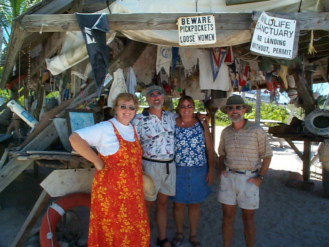 We dinghied into Little Harbour through rollers so big we could not see the boat while in the troughs. We tied up to the visitors dock to and sallied forth to explore. The first stop was of course the famous Pete's Bar. We had lunch there and the ladies staggered out into the sunlight after only two of the drinks, for which he is famous. The recipe includes seven types of rum and a splash of fruit juice! The seclusion of this popular but remote anchorage has attracted artists like the renowned sculptor
 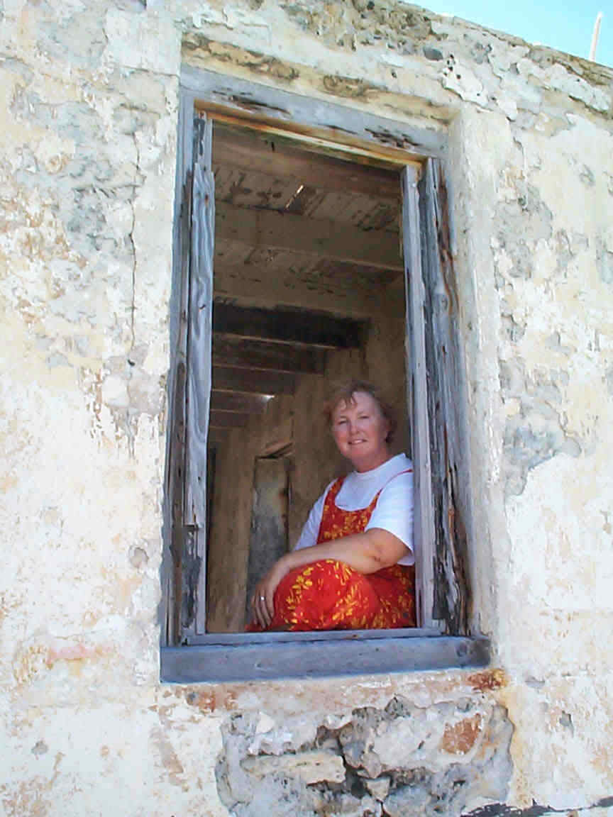 Randolph Johnston and his wife Margot who worked with ceramics. Their son's Pete now runs Pete's Pub and their gallery.
We explored the island admiring several of the beautiful homes and rental cottages and checked out the now totally automated lighthouse. The previous lighthouse was lying on the ground beside the remains of the building.
LYNYARD CAY TO HOPE TOWN
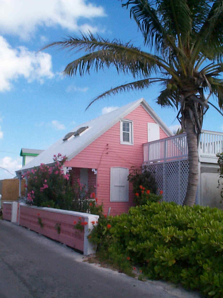
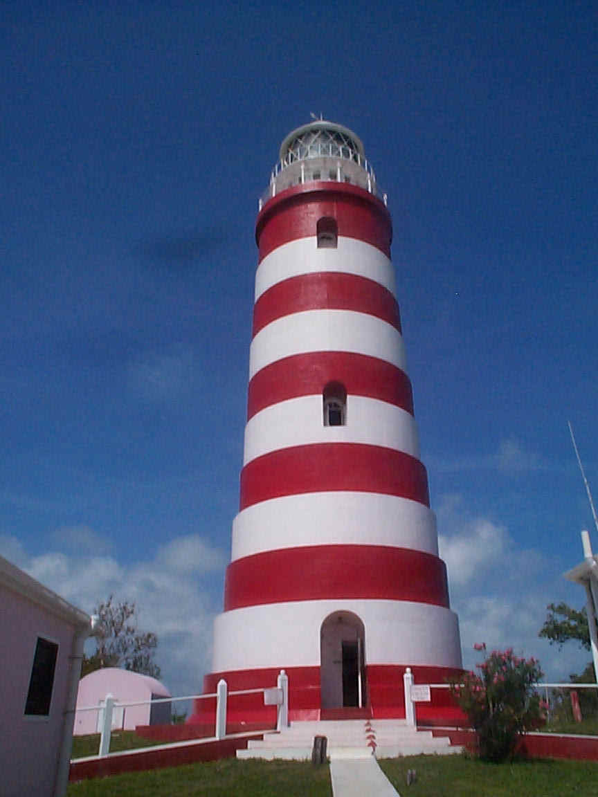
From Lynyard Cay we traveled north through very shallow areas picking our way through with thee computer charts and the Explorer Charts and using the tide to our advantage. We anchored outside Hope Town as it also required high tide to get our boats in and a call on the radio ascertained that there were no available moorings in this beautiful but very tight harbour.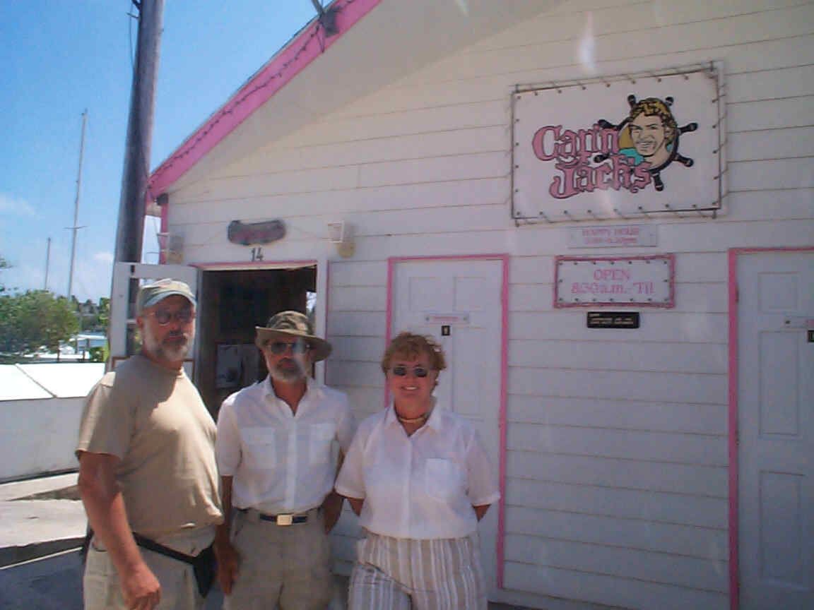 We visited Hope Town by dinghy for 2 days, enjoying the very pretty houses and a visit to the famous lighthouse. On the first day we lunched at a very pretty over the water café and ran into Ron and Carol on Summertime Love of Mimico Cruising Club. We had previously spoken to them by radio on our way down the ICW but had not actually met them since we left the club. They had spent several months in Florida and had been in the Abacos for only two or three weeks. They were planning their return to Florida. We were planning to go to Marsh Harbour where we would meet our daughter Michelle and our grandson Devin.
HOPE TOWN TO MARSH HARBOUR
We arrived in Marsh Harbour and took up a dock at the Conch Inn and Marina as a major front arrived and which we hoped would pass through quickly.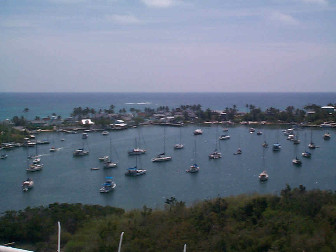 We stayed there for several days but the front remained stationary causing 20 -25 knot winds with 30-knot gusts every day. Later we anchored in the harbour and tried to use the ferry system to get around. We took a ferry to Guana Cay for a Barefoot Man Concert and surprise, we met Ron and Carol of Summertime Love again. Cruisers are truly a small community.
We dinghied over to The Jib Room Marina in Marsh Harbour and then to Mermaid Reef Beach with Steve and Val but found that it was too far to swim out in the choppy sea condition.
 The next day we took the ferry to Hope Town to allow Michelle to see this beautiful community. While lunching at the Hope Town Harbour Inn, we met three people after their table umbrella, broke while we were all lunching. Two of them were married and were airline pilots with Delta. The other was a stockbroker. They live in Orlando but rent a house in Marsh Harbour for a month every year.
It was a very nice place, with the ocean view, swimming pool, and good food.. Diane and Michelle took Devin out for a "swim" while Jeffrey talked to his new friends from Orlando.
The next day we took the ferry to Hope Town to allow Michelle to see this beautiful community. While lunching at the Hope Town Harbour Inn, we met three people after their table umbrella, broke while we were all lunching. Two of them were married and were airline pilots with Delta. The other was a stockbroker. They live in Orlando but rent a house in Marsh Harbour for a month every year.
It was a very nice place, with the ocean view, swimming pool, and good food.. Diane and Michelle took Devin out for a "swim" while Jeffrey talked to his new friends from Orlando.
In the middle of this Jeffrey became a bank robber without even knowing it! He was pursued by a CIBC employee, Latrisha Burrows, who had driven all over Marsh Harbour to find him. He had requested a $500 MasterCard advance and had received the money but the slip was for only $200. Neither of them had noticed the error. Luckily for her she ran into Steve who was ashore in his dinghy. Steve motored out and Jeffrey motored in to be transported to the bank in her car and requested to sign for the other $300.
